Less than three weeks after a deadly earthquake hit Iran’s western province of Kermanshah, a temblor measuring 6 on the Richter scale struck a southeastern area near the city of Kerman on Friday morning, but caused no casualties. The epicenter of the Friday morning earthquake was a mountainous region 58 km northeast of the provincial […]
Less than three weeks after a deadly earthquake hit Iran’s western province of Kermanshah, a temblor measuring 6 on the Richter scale struck a southeastern area near the city of Kerman on Friday morning, but caused no casualties.
The epicenter of the Friday morning earthquake was a mountainous region 58 km northeast of the provincial capital, Kerman, a historical city with a population of more than 3 million.
The quake occurred at 02:32 UTC at a depth of 10 km, according to the United States Geological Survey (USGS).
The closest Iranian cities to the quake center are Kerman, Zarand, and Ravar.
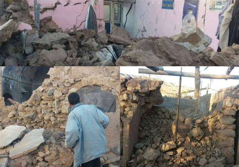
Tasnim dispatches say the quake has destroyed a number of houses in rural areas, causing power cut and forcing people to remain outdoors.
Speaking to Tasnim on Friday morning, governor of Ravar said no loss of life has been reported so far.

The quake follows a massive temblor that hit Kermanshah on November 12, killing more than 480 people and injuring around 10,000 others.
Iran is one of the most seismically active countries in the world, being crossed by several major fault lines that cover at least 90% of the country.
The deadliest quake in Iran’s modern history happened in June 1990, devastating many areas in the northern province of Gilan and killing around 37,000 people.
In 2003, a magnitude 6.6 earthquake in the province of Kerman flattened the historic city of Bam, killing more than 26,000 people.


